
Google Maps is the name of the tool developed by Google to provide users with all the information they need about their location, as well as that of any specific address. The tool is available as a mobile application, but can also be accessed via the Google Maps website using a web browser.
Google Maps has been an Internet staple for over a decade now, but few people really know how it works or how to use it effectively. For the rest of us, Google Maps is pretty much one step away from magic.
For example:
- How does Google create such precise maps for so many different regions?
- How can it collect so much data on so much of the entire world?
- Who works to keep the maps up to date?
- And what about real-time traffic conditions, temporary speed limits and opening hours of nearby businesses?
One way or another, all these complex features work very well, which is why millions of people rely on it every day for daily navigation. Statistically, the mobile app already has over a billion downloads on Play Store.
So isn’t it time we learned how it all works, and how to use it as a business or an individual?
Read on to find out the answers to all your questions.
Chapter 1: What is Google Maps?
In this chapter, we’re going to take a look at the most important aspects of Google Maps, so that we can better understand what it’s all about.
1.1 What is Google Maps?
Google Maps is a mapping tool that lets you geotag a specific point, estimate the distance between two points, find the nearest places of interest and much more.

Although it can also be accessed via the official website, the mobile application version of Google Maps is more widely used.


The latest version of this application includes new, even more useful features:
- Offline map access;
- Street View;
- Interior views of key locations such as airports and stadiums;
- Etc.
Once the application has been downloaded onto your mobile device, you can define your personal settings by entering addresses such as your home, work or other frequent destinations.
This way, they can be found using quick searches, avoiding having to write down the whole address each time.
What’s more, you can measure the distance between two destinations, search for a location in the browser, zoom in on an image or enlarge a frame…
When you activate your phone’s location, you can also see your geographical position, so you know where you are at all times. The application also displays all places of interest close to your position, thanks to the GPS signal.
What’s more, when you type in a location on Google, the search engine automatically suggests it on Google Maps.
1.2 Google Maps: Map, satellite, Street View and browser
The maps displayed on Google Maps can be of different types.
- Globe view: Used by default, this interface displays streets as on a normal topographic map.

Depending on the zoom level selected, it displays increasingly detailed information, up to and including icons of all places of interest on a street.
- Google Maps Satellite: Here, the application uses satellite images to present the Maps map.

Satellite maps are not often up to date. They will not, for example, show unfinished building sites in real time.
- Street View: displays the street in photographic detail, using 360-degree images. You can then see the road from ground level, as if you were actually there.

Google’s algorithm masks people’s faces and eliminates details that could create privacy issues. Not all areas may be covered by Street View.
- Google Maps Navigator: When you choose to follow Google’s navigation, the interface changes to show your movement and point the way.
1.3. What Google Maps does
Google Maps helps you locate a place, person or object anywhere on the globe. It lets you see topographical maps in real time and move around to find out how to get to any place.
For your travels, Google Maps also lets you know which means of transport will get you there sooner, and which route you can take.
True, we’re talking mainly from the user’s point of view, but when it comes to a company’s global vision, Google Maps brings more benefits.
In this case, it’s a tool that makes it physically easier for companies to identify where they are.

By effectively combining search engine optimization strategies with the use of this application, you’re likely to see a positive improvement in web traffic and customer conversions.
1.4. Some feature improvements after the latest update
With the Google Maps update, old features have been improved, but attention has been focused on developing 4 important functions. Explore: When you’re looking for a nearby place to eat, listen to live music or have fun with friends, this tab lets you find information, ratings, reviews and more on millions of places around the world ;

- Itinerary: If you’re traveling by car or public transport, the “Itinerary” tab will suggest the optimum route.

You can configure your route to get real-time updates on traffic, travel times and suggested alternative routes;
- Saved: This tab is a central location for users to find their saved locations, plan group events and share recommendations on places they’ve visited in the past;
Contributions: Every year, hundreds of millions of people contribute to keep Google Maps up to date.

With the new ”Contributions” tab, you can easily share local information such as street or address details, missing addresses, business reviews and photos.
Each of your contributions is valuable, as it helps other users discover new places and decide what to do;
So far, this is just a small selection of Google Maps features. Let’s go into more detail now:
Chapter 2: Functionality and use of Google Maps
Google Maps has been around for some time, but many people are unaware of the full range of services it can offer.
Its functionalities are numerous, and Google is constantly adding to them to make it a highly accurate tool capable of anything.
Let’s take a look at some of the main features of Google Maps that you can use when you need them.
2.1. Measure the distance between several points
Want to plan your morning jog or perhaps just know exactly how far you need to travel on a particular journey?
Maps’ distance measurement function makes it easy to determine the precise distance between any number of points.
On your phone, press and hold your finger on your starting point. This will bring up a red pin with a white bar indicating more information about the location.

Swipe up on the bar in iOS or tap on the bar in Android, then select the “Measure distance” option.

After that, click on the blue icon ( ) to search for the second point. Repeat as many times as possible to measure your complete route.

On a computer, simply right-click on your starting point and select “Measure distance” from the menu that appears:

Then click on each subsequent point on your route to obtain measurements.

2.2: Save time with advanced gestures
Beyond pinching to zoom, Maps offers many other useful gestures to help you navigate the application on your mobile device.
Try these advanced maneuvers:
- To zoom in or out on a map with one hand, double-tap and then, without lifting your finger, swipe up or down on the screen.
- Rotate a map to change your orientation by placing your index finger and thumb on the screen, then twisting them together to the left or right.
- Change perspective by placing two fingers on a map and dragging them both upwards on the screen. This will take you into a “bird’s-eye” view of the area you’re looking at, with three-dimensional buildings in many places.
- Want to save a step the next time you’re ready to navigate? After searching for a location, press and hold the blue “Itineraries” button at the bottom of the screen. This will take you straight into navigation mode, using Google’s best guess for the route and mode of transport you’re likely to use.
2.3. Become (or consult) a Local Guide
Think you know your neighborhood better than Google’s algorithm? Then become a Local Guide.


While anyone can leave reviews and tips in Google Maps, Local Guides lets you earn points by leaving more information and data which, as you grow, Google says can give you access to:
- Higher levels of the program ;
- Benefits such as early access to Google features;
- Special partner benefits.
2.4. Go unnoticed
Like most Google services, Maps uses your in-app searches and actions to personalize your future suggestions.
But if you’re going somewhere you don’t want to record or associate with your account, Maps offers a useful new feature that lets you go unnoticed and avoid recording your activities.
To access it, simply tap on your profile icon in the top right-hand corner of the Maps interface on your phone, then tap on “Enable private navigation mode” in the menu that appears :


The app will reload, and you’ll see a gray bar at the top of the screen informing you that private navigation mode is enabled, as well as a dark private navigation mode icon in place of your usual profile photo.

When you’re ready to return to normal, press the private browsing mode icon and select “Deactivate private browsing mode”.

2.5. Traffic check
Getting stuck in traffic is a horrible experience. It’s just a universal truth. Google Maps helps you avoid this car hell by letting you know which routes have the most traffic and which have the least.
It doesn’t matter whether you’re in Paris or London in the UK, or New York in the USA, this feature gives you perfect traffic information.
2.6. Beneficial for lesser-known businesses
Being listed on Google Maps with accurate information is now a crucial factor for any business with a physical location, especially start-ups.
The free advertising is incredible. What’s more, users can find what they want, along with instructions on how to get there.
Users can add reviews and photographs to the listing. But one of the most beneficial features is that people can see what time a business opens and closes, and even what time and day it’s busiest.
That said, anyone wishing to buy your wares can find your start-up’s opening and closing times without needing to call you.
2.7. Globe view
If you open Google Maps on your computer and access Globe View, you can see the Earth as a satellite would. You can rotate and zoom in on places, and even look at other planets in the solar system.
You’ll see the Earth mapped as it really is, as a 2D map can never be accurate in wider views.
The feature is not available on the smartphone app, but the globe view and much more are accessible via the Google Earth app.
2.8. Google Maps partnership program
Google Maps collaborates with other organizations to obtain data on:
- Places of interest ;
- New roads;
- Aerial images;
- Public transit routes;
- Timetables;
- Fares;
- Etc.
Partners include thousands of governmental and non-governmental organizations around the world.
The problem with using third-party sources is that government restrictions and policy changes can have a negative impact on map quality.
Problems also arise when marking borders for disputed territories.
2.9. Satellites
Google Earth and Google Maps use satellites to capture views from above. Satellite views are also used to verify data collected from other sources, ensuring that they have not been incorrectly or obsoletely reported.
Satellites capture:
- Street markers;
- Building locations;
- Spacing;
- Etc.
2.10. Crowdsourcing
Crowdsourcing for mapping is particularly important in developing countries or countries with government restrictions. In other words, countries where Google may not be able to obtain accurate data directly.
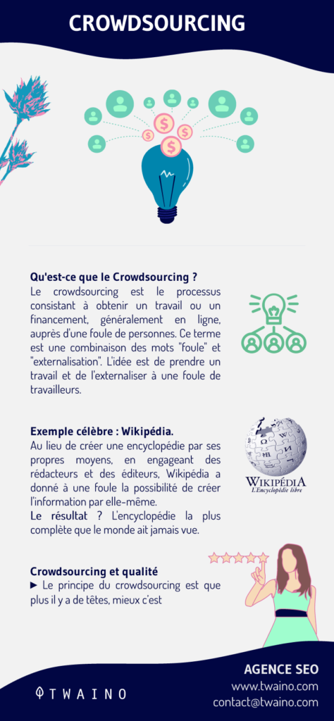
Previously, Google Maps had a feature allowing users to make changes to maps, but this was removed from the platform after reports of vandalism.
The Locale Guides community helps to add additional information to maps, but not to modify maps indirectly. In addition, business listings are generally generated from third-party sources.
But to avoid duplicate or inaccurate information, businesses are encouraged to register on the Google My Business platform and provide up-to-date information.
User contributions provide businesses with additional details, such as reviews, photos and opening and closing times.
Google data shows that users submit over 20 million contributions every day.
2.11. Street View
As one of the features of Google Maps, Street View presents the world virtually through tons of images. It offers users close-up views of breathtaking places and landscapes around the world.
To enable users to explore the world virtually from anywhere, Google uses two sources to collect 360-degree panoramic photographs.
These images come from both Google Street View devices and user contributions.
The Street View fleet Google uses to collect images includes:
- Cars;

Source : Google Street View
- Snowmobiles ;

Source: Google Street View
- Tricycles ;

Source: Google Street View
- A stroller-style camera system called Chariot ;

Source: Google Street View
- And a portable backpack called Trekker.

Source: Google Street View
Custom configurations like underwater cameras are used for special circumstances. For their first underwater expedition, Google captured the Great Barrier Reef.

Data from Street View machines is also used to verify and correct existing data from other sources.
Road signs captured and processed by technologies such as OCR can even be used to correct business listings with precise addresses.
It is estimated that there are currently over 250 Street View cars on the streets of the world.
Google focuses mainly on the USA, Europe and other popular tourist destinations for its map tours. Here’s an overview of the areas covered by Street View:

2.12 Add your own Street View images
Google lets Android usersadd their own photos to the mapping function.

But first you need the latest version of theStreet View app on an Android that supports ARCore.
2.13. User location data
If you use Google Maps and keep location services on your phone, whether you know it or not, you’re providing your data to Google Maps.
Back in the day, Google used data from traffic cameras and the like to estimate traffic conditions, but now a much more efficient system is in place.
Google receives the location and speed of travel from every smartphone that uses Google Maps, and the data is collected from a number of these phones on the road.
This real-time data, combined with historical data on the usual traffic at a location can be used to predict a place’s traffic density with pretty good accuracy.
This is how you get your real-time traffic updates. This user data is also used to determine the times of day when lanes are most congested.
2.14. Quickly find nearby services
For example, in an emergency, if you’re looking for a hospital close to your area, simply click on the Google Maps search bar (make sure the field is empty) and tap on a service of your choice at the bottom of the screen.

You’ll be shown the hospital closest to your current location. In the same menu of service choices, you’ll find:
- Gas stations ;
- Grocery stores ;
- Pharmacies;
- Restaurants;
- Hotels;
- And other businesses.
2.15. save a cool place to remember later
The next time you discover a cool new bar, search for the location on Google Maps and click “Save” on the business info card.

Saved places appear as favorite locations on your maps and can be accessed by selecting “Your addresses” in the Google Maps menu, then “SAVED ADDRESSES” :

On iOS mobiles, you’ll see :

2.16. Consult train and bus timetables
There are many apps dedicated to tracking public transport timetables, but often Google Maps is all you need.
Ask for directions to a given location, and Maps will automatically queue up a variety of transit options, including scheduled departure times for different buses and trains.
You can also tap the bus, train or metro icons on the map itself to display departure and arrival times.
2.17. Share a position or location with friends
If you’re in a place that’s hard to find, such as a large park, you could get lost. Google Maps makes it easy to mark a pin at any location, then share that location with friends.
Thefirst option is simply to click on a fixed point of interest on the map. A menu will then appear at the bottom of the screen, where you simply click on the “Share” button at the bottom of the screen.

After clicking this button, simply choose the contact or application with whom you wish to share the location.
For example, you can share with your friends a restaurant where you’re going to dine, or a casino center where you’re going to gamble.
In the second case, you want to share your location in real time for a certain period of time, so that the person receiving your link knows where you’re going at all times.
You can share it for certain hours, or indefinitely until you deactivate the option.
To share your location, click on the blue Google Maps dot indicating your current position.
A list of options will then open up at the bottom of the screen, just press ”Share your location”.
You’ll be taken to a screen where, at the top, you can choose how long to share your location, and below that, you can choose who to send the link to:
The sharing link can be sent by SMS, e-mail or via social networks.
By pressing the Save icon, you can choose to put the location in :
- Favorite addresses ;
- To visit ;
- Saved addresses;
- Or create a New list and name it.

You’ll find them under “Your lists” via Menu >> Your addresses >> Saved addresses:

2.18. Plan a multi-stop itinerary
If you’re going on a trip, you can use the desktop version of Google Maps to combine multi-stop itineraries into a single multi-stop itinerary.
Click on the search box in the top left-hand corner of the screen, then click on “Itinerary”.
Then click on one of the icons at the top of the screen according to your means of transport.
Let’s take the example of a car journey. After entering the first location you wish to travel to, a sign ( ) will appear under the last destination.
Click on the sign to enter the next location on your journey.

When you’ve finished, Maps calculates the total mileage of the trip and provides detailed, easy-to-print instructions.

2.19. Delete your map history
Google uses a feature called Location History to track the movements of Android users logged into their Google accounts. You can see your own location history map here.


If you didn’t know the feature was enabled, the tool is able to trace the steps of your crazy last evening.
You can disable location history tracking, by going to Settings on your Android device, then Location.
The other option is to visit the Google websiteAccount History, which allows you to enable or disable various data collection services.
2.20. Time travel with Google Maps
Street View has amassed a huge collection of street images over the years. In 2014, Google introduced Time Travel (a kind of machine that virtually goes back in time) to allow users to see how Street View has changed over time.
It’s a little-known feature that lets you look at the street view of any area as it existed at various times in the past.
This one only works from the desktop site, so open Maps on your computer and choose a location.

You’ll see a little yellow guy in the bottom right-hand corner, known as Pegman:

Drag him with your mouse and drop him where you want to go.

Next, look for the clock icon in the gray area at the top left of the screen.
Press it and you’ll be able to drag a slider back in time to see 360-degree views of previous years.
The feature isn’t available for every possible location, but it’s quite widespread and many places have a full decade of data.

For more details on changes to the Earth’s surface between 1994 and 2018, see Google Earth Engine.
2.21. Get parking information before you drive
Nothing is more annoying than arriving somewhere at the last second, then struggling to find where to park.
Maps can help: Before you hit the road, search for your destination in the Google Maps app on your phone.
On Android, tap the Directions button at the bottom of the screen, then tap “Stops & Parking” and look for the “Find Parking” option.
On iOS, press the “Steps” button at the bottom of the screen, then look for the “Find Parking” link towards the center of the screen.
Just note that the parking function isn’t available in some cities, and Google doesn’t specify them. So if you don’t see the “Find parking” option, it may not be available in your area at the moment.
2.22. Automatically delete your Google Maps location history
Google lets you periodically delete your location history from the company’s servers. You can set the data to be deleted every three months, every 18 months or keep the data until you delete it manually.

Go to myactivity.google. com and click on Location History > Auto Delete, where you can choose how often to delete your data, including where you’ve been on Google Maps.
2.23. Use voice commands
Many people have the habit of consulting their mobile device while driving, either to check the next turn or to see how much time is left for a journey.
To avoid this, Google Maps offers a range of useful voice commands that will work whenever you have active navigation.
Simply press the little microphone at the top of the search bar:

And you’ll come to this page:

Then speak, trying out variations, such as:
“What route is this?”
“What’s my next turn?”
“What’s my ETA?”
“How’s the traffic?”
“How’s the traffic going?”
” Avoid tolls “
” Avoid freeways “
” Find service stations “
” Find restaurants “
” Go back home “
” Take me to McDonald’s “
” What’s the nearest hotel? “
” Exit navigation “
You can also ask your phone to make calls, send text messages, listen to music or search for your next appointment, all without taking your eyes off the road.
2.24. Remind you where you parked
Open Maps on your iPhone or Android phone and tap on the little blue dot that represents your current position.

This will bring up a hidden menu with some handy options, including the ability to save your current parking location.

You can add your own additional notes or photos, and even set a timer to remind you when it’s time to move your car.
Everything you need to remember where you parked is right there in the Maps mobile app.

When you’re ready to return to your spot, search for the saved parking notification on your phone, or simply open Maps and tap on the “Parking Location” map at the bottom of the screen.
2.25. Receive personalized commute notifications
When it comes to your standard daily commute, let Maps help you avoid headaches by proactively alerting you to journey times and any heavy traffic or delays on your route.
To set up your personalized commute notifications :
- Press the menu icon in the top left-hand corner of the mobile app and select “Settings” then “Home or work address” :

This will bring up a screen where you can specify (or confirm) your home and work address, then give Maps information on how as well as when you usually make your trip.

Fill in all the fields and make sure you activate the “home-work info” notification button.

2.26. View time-specific traffic estimates
You can find out how long a journey is likely to take at any given time with Maps’ intelligent traffic estimation tool.
Simply search for a location in the desktop version of Maps, then click on the “Route” button and enter the starting point of your choice.
At the bottom of the same box where you typed the address, you’ll see a line marked “Go now”:

Click on the downward-pointing arrow next to it, then select “Depart at” or “Arrive at” to display the likely traffic conditions and estimated trip total for a specific day and time.


Maps’ traffic estimation tool will help you determine the time you need to drive away, even if you don’t hit the road right away.
2.27. Google Maps for offline directions
This feature lets you use maps even when you don’t have an internet connection. But to download a map for offline use, you first need an active connection.
To download, simply click on the desired location and press the “menu icon” in the top right-hand corner of the mobile screen.

Then launch the download by clicking on “Offline maps”:

Once the Google map has been downloaded, you can view it even when you’re offline.
Please note that maps can only be downloaded using the Google Maps applications for smartphone or tablet.
Chapter 3: Google Maps for business
Google Maps offers businesses a wide range of features to improve their visibility.
Using technology, you can ensure that your business has an impact on the user when they access your informative content, significantly increasing conversion.
3.1 How does Google Maps Marketing work?
Google Maps Marketing, or Marketing on Google Maps, is the section of digital marketing that focuses on Google’s geolocation services.
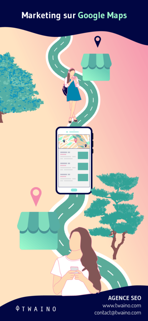
Their strategies go far beyond simply inserting the address of local businesses on the map, and include promotion, advertising and customer relations.
All address management is carried out using Google my business, Google’s free tool developed to serve local businesses and help them promote their brands, products and services.
In addition to the fact that Google Maps is the world’s most widely used geolocation service, several other applications, such as Waze and Facebook, use it on their platforms. Best of all, it costs virtually nothing to use.
3.2. The main benefits of Google Maps for your business
Speaking of the benefits of marketing on Google Maps, it’s important to point out a few key elements that justify the importance of starting a Google Maps marketing strategy.
3.2.1. Online visibility
Even if you’re just starting out on the Internet and don’t have a website or social networking strategy, Google Maps lets you have a quality online presence at no cost.
The exposure the platform offers is impressive. Just think, your business could appear on millions of GPS-enabled cell phones, tablets and smart TVs in your area.
Decades ago, for an organization to achieve such visibility would have required investments unimaginable to most entrepreneurs.
According to research, 53% of consumers always look for information about a company before buying something online or visiting a physical store.
3.2.2. Measuring data
Another advantage of having a presence on Google Maps is the ability to analyze the information and metrics of users who visit your online profile.
This data measurement is essential to better understand your customer and build a more realistic profile of your target audience and personality.
In marketing and sales strategies, knowing your potential customer in depth, and in as much detail as possible, is one of the most important sciences.
In this way, your company can develop actions and campaigns to achieve better results in both sales and customer relations.
3.2.3. Customer relations
Trust can be a decisive factor in whether or not a consumer buys from your company. But customer feedback can also be a decisive factor in the decision to buy.
For example, one of the features of Google Maps combined with Google My Business is that customers can rate and write reviews of your business.
It is therefore advisable to respond to reviews and show users that you are striving to improve your services.
3.2.4. Helping traffic and conversion
Google Maps offers outstanding features that improve traffic and business conversion. This applies in particular to users who prefer to search for information on the Net before going to the physical store to make a purchase.
If the user accesses information relating to your company, you have the opportunity to inform them of certain decisive aspects when visiting or purchasing one of your products or services in a physical store.
For example, a section on the range of indicative prices for the customer, or a graph showing how busy the public is at certain times or days of the week. These two functions can be decisive in increasing a company’s traffic and sales.
3.3: How can I position myself better on Google Maps?
The biggest advantage of marketing on Google Maps is that, whatever your position, users will identify you.
However, a few suggestions can help you achieve even better results.
3.3.1. Describe your business as best you can
Geographical distance is undoubtedly the most important factor. However, company details such as business area, address, opening hours, website and main offers also have an impact on ranking.
So you need to provide as much information about your company as you can, to make it more complete in the eyes of users.
3.3.2. Take advantage of Street view
Thanks to Street View, Google is able to present your company in full image to your customers.
To do this, it’s important to add the most relevant photos of your business and your company logo.
If you run a hotel, for example, it would be a good idea to insert photos of the rooms.
Another suggestion is to hire a photographer to create a tour inside your establishment and make it accessible via Street View.
3.3.3. Advertise on Google Maps
Relying on advertising is always an interesting alternative for increasing the visibility of your business and attracting more customers to your physical store.
To this end, Google Maps has an advertising system called Google Maps Ads to make it much easier for your target audience to find you.
Another tip here is to never see Google maps marketing as a random expense. Indeed, it’s another important investment your business can make to reap the benefits we’ve mentioned above.
Chapter 5: Other questions about Google Maps
In this final chapter, I’ll provide clear and precise answers to some frequently asked questions. If you can’t find an answer to any of the questions raised here, the Google Maps FAQ platform can help.
5.1. What year was Google Maps created?
Google Maps has been around since 2005. But since then, the tool has evolved and improved year after year.
5.2. How does Google Maps work?
- GPS technology known as “where 2 technologies” and a group of satellites collect all images and data from space.
- Local governments and users help tag places and locations.
- Android devices in motion help share data with Google to give an accurate traffic status.
The last point is why Google Maps is more accurate than Apple Maps.
5.3. Why did Google launch Maps?
Google’s public mission is “to organize the world’s information and make it universally accessible and useful”. Many, but not all, of the company’s current projects focus on this mission.
A mission that relies on collecting, organizing and interpreting millions of gigabytes of data.
But the information Google is trying to organize isn’t just online. Much of it is offline.
Speaking to The Atlantic, Manik Gupta, senior product manager at Google Maps, recalls: “As we go about our lives, we’re trying to bridge the gap between what we see in the real world and [the online world], and Maps really plays that role.”
From the start, Google Maps has taken a huge amount of offline information and published it online. This includes things like road networks, street signs, street names and business names.
Google hopes Maps can do much more in the future.
5.4. How can Google Maps make mistakes?
Every day, many changes are made to Google Maps. Some of these may be the addition of new locations and routes, while other changes may involve the correction of errors.
Many of these are corrected by chance by members of the public: modifying place descriptions, adding roads, etc.
Yet on top of this, Google has a large team of people working on the thousands of reports submitted every day.
A large proportion of these reports are reviewed and processed manually. This is done usingAtlas, Google’s own map-editing program. New routes are drawn by hand, roads are connected, new buildings are plotted, and so on.
It’s a project that will never end. With thousands of new roads being built every day, and cities changing traffic rules as necessary, Google Maps will always be fighting to stay accurate.
5.5. How does Google Maps work offline?
To get the most out of Google Maps, you need to make sure you have a reliable Internet connection. But that doesn’t mean you can’t use the navigation app in dead zones.
Google Maps lets you download maps of certain areas to your phone so you can access them offline. It’s important to note that you need to be connected to the Internet to save these maps on your device.
But once downloaded, you can access them at any time, whether your phone is online or offline.
5.6. What are the limitations of Google maps offline?
When downloading maps for offline use, you will only be able to access road routes, as public transport, cycling and walking routes are only available online.
With offline maps, you won’t receive the latest changes to routes or locations, unless you activate the automatic update function.
What’s more, you need plenty of storage space on your cell phone to be able to download an offline map.
Conclusion
Overall, Google Maps is a web-based platform that gives users all the information they need about their location and any other place in the world.
What’s more, it enables businesses to gain visibility and be easily spotted by new customers.
In addition to being a powerful location tool for users, Google Maps is also considered a good way to improve local SEO for businesses.
To capitalize on the benefits of this tool, we’ve listed in this article a few ways you can use Google Maps to succeed in your local SEO strategy.
I hope you’ve found this guide useful, and that it has a positive impact on your business! Don’t hesitate to leave me comments on your impressions!
Thanks and see you soon!